Right-of-Way Software for Gen-Tie and Interconnection Corridors

Land and Right-of-Way Management for Solar, Wind, Storage, and Geothermal Projects
Know Where Land Control Stands Across the Whole Route
See acquisition status in real time across corridors and parcels, with agreements and payments grouped under a project record for consolidated visibility into acreage, financial exposure, and deal status before execution. Assign land agents and balance workload across teams so unsecured parcels surface before they threaten construction or energization.
System of Record for Gen-Tie and Interconnection Land
Every agreement behind a grid connection lives in one record: gen-tie easements, collector system parcels, substation and switchyard sites, and access roads. Option deadlines, interconnection milestones, and land control status stay visible to development, engineering, and construction teams from route selection through energization.
Track a Route from Option Exercise to Energization
Option windows, exercise deadlines, temporary workspace terms, and permanent access provisions are tracked against the parcel they belong to. Teams working to an interconnection schedule can see which commitments come due next and which parcels still need to clear before construction mobilizes.
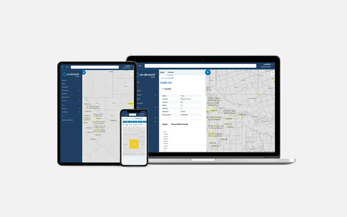
Corridor and Parcel Mapping Built on Esri ArcGIS
Visualize corridors, centerlines, parcels, facilities, and environmental constraints with embedded Esri ArcGIS, 3D parcel modeling, and custom layers. Spatial data stays synchronized with land agreements and obligations in a single governed environment.
Coordinate Hundreds of Landowners and Outside Agents
Maintain a centralized database of landowners and stakeholders including contact details, communication history, assigned agents, agreement terms, and compensation tracking. Role-based permissions let outside agents work alongside internal teams with controlled access to sensitive data.
Permits and Compliance in Every Jurisdiction You Cross
Track federal, state, and local permits, inspections, environmental and cultural assessments, and renewal dates across every jurisdiction a corridor crosses. Automated alerts and auditable records help teams avoid missed obligations and stay prepared for regulatory reporting.
Landowner Payments and Renewable Royalty Calculations
Manage compensation schedules, rentals, and escalations with approval workflows and auditable records. For portfolios that also hold generation, On Demand Land calculates wind and solar royalties with greater-of logic, production data, and true-ups in the same system.
AI-Assisted Document Review Within Governed Workflows
AI-assisted document review and data extraction are available within governed workflows, aligning agreement terms to land data fields and linking every value back to its source text. Users validate outputs before they become part of the system of record.
Secure Cloud Platform Connected to Your Project Stack
SOC 2 Type I and Type II compliant, with auditable access, change tracking, and no scheduled downtime for updates. REST APIs move landowner payments, accruals, and export-ready outputs into ERP and accounting systems including SAP, and push parcel and corridor data to the GIS and field tools interconnection and construction teams already run.
Energy Point Consulting Advances Renewable Land Management
Learn how Quorum helps advance renewable energy land management through comprehensive, data-driven solutions. Energy Point relies on On Demand Land for real-time asset management, enhancing transparency and optimizing contract and payment processes.

15+
Years in Renewable Energy Development
ZERO
Downtime When
Delivering Updates
3M+
Land Assets Managed
in On Demand Land
Esri Cornerstone Partner
Quorum Software is a long-standing Esri Cornerstone Partner with over two decades of experience integrating ArcGIS technology into land and infrastructure workflows. This partnership enables accurate spatial analysis that stays synchronized with land records and agreements.

Renewable Right of Way and Land Management Key Features
Track permanent and temporary easements, construction rights, surface use agreements, and maintenance access across your full corridor footprint. Manage compensation and access restrictions with full auditability.
Visualize corridors with centerline mapping, integrate parcel boundaries and easement extents, apply spatial overlays for planning and compliance, and view multi-layer maps for facilities, environmental constraints, and land use. Built on Esri ArcGIS technology, with spatial data kept synchronized to land records.
Integrated document management with automatic OCR on import and universal search across structured land data and document content. Data Extraction aligns agreement terms to land data fields with every value linked back to its source text for validation, and documents link directly to parcels, easements, agreements, and projects.
Centralize landowner contacts and communication history, and automate notifications for payments, access requests, and maintenance activities. Assign land agents, balance workload across teams, and collaborate securely with internal and external stakeholders.
Track landowner payments, accruals, and export-ready outputs, with configurable approval workflows before amounts reach accounting. For portfolios that also hold generation, calculate wind and solar royalties using greater-of logic, production data, and true-ups, alongside fixed and index-rate escalations.
Track permits, inspections, and renewal dates across every jurisdiction a corridor crosses. Support regulatory reporting with auditable records and a clear audit trail for internal governance.
A System of Record for Right-of-Way and Infrastructure Land
Right-of-way agreements, permits, landowner records, and spatial data must stay accurate, auditable, and accessible for decades. On Demand Land unifies right-of-way, land data, GIS, and compliance workflows in one secure platform built for renewable developers, operators, utilities, and transmission owners.
FAQs
On Demand Land by Quorum Software is a cloud-based land and right-of-way management platform used by renewable developers, operators, utilities, transmission owners, and infrastructure owners to manage easements, access rights, landowner agreements, permits, payments, and spatial data in one governed system of record.
It covers the land work that continues past the project boundary: gen-tie routes, collector systems, substation and switchyard sites, access roads, and interconnection corridors.
A gen-tie line, short for generator tie line, is the transmission line that carries power from a renewable generation project to its point of interconnection with the grid. It can run a few hundred feet or many miles, and it usually crosses land the project does not own.
The land beneath it is secured through easements and access agreements negotiated with each affected landowner, typically by the developer's land or right-of-way team or by contracted land agents. On Demand Land holds those agreements, their obligations, and their spatial records in one system, so land control along the route is verifiable at any point.
Acquisition generally follows route selection, title review, landowner outreach, option or easement negotiation, and execution, with survey and permitting work running alongside. Each parcel along the route is a separate negotiation, and the route becomes usable only once every parcel is secured.
On Demand Land tracks each parcel's status under a single project record. Teams can see acquisition progress across the whole route, assign and balance agent workload, and surface unsecured parcels before they affect the construction or energization schedule.
On Demand Land supports solar, wind, storage, and geothermal projects. The land model is technology-agnostic, so parcels, easements, agreements, obligations, and payments behave the same way regardless of what the project generates.
That matters for mixed portfolios. A developer running solar in one region and geothermal in another, or a utility holding generation alongside the transmission that serves it, keeps all of it in a single governed land record.
Yes. The platform manages permanent and temporary easements, construction and maintenance access rights, surface use restrictions, and compensation tracking from acquisition through long-term operations.
Rights of way are managed through the same configurable workflows used for leases and acquisitions, including draft agreements, project-based tracking, and lifecycle transitions through to executed agreement.
Embedded Esri ArcGIS capabilities allow teams to visualize corridors, centerlines, parcels, facilities, and environmental constraints. Spatial data stays synchronized with land agreements and obligations in a single governed environment.
3D parcel modeling and custom layers support corridor review, and spatial analysts can use Esri ArcGIS Pro for more complex workflows. Quorum is an Esri Cornerstone Partner with over two decades of ArcGIS integration experience.
Yes. The system maintains a centralized database of landowners and stakeholders including contact details, communication history, assigned agents, agreement terms, and compensation tracking. This supports coordinated outreach and workload management across teams.
Role-based permissions and collections allow brokers and outside land agents to collaborate with internal teams while access to sensitive data stays controlled, which matters on corridors where acquisition is distributed across many parties.
The platform tracks federal, state, and local permits, inspections, environmental and cultural assessments, and renewal dates. Automated alerts and audit trails help teams avoid missed obligations and stay prepared for regulatory reporting.
Because a single corridor frequently crosses multiple counties and states, permit and condition tracking is organized against the corridor and the parcels it affects rather than held separately by jurisdiction.
Land control status is visible at the project level, so teams can see which parcels along a route are secured and which are outstanding before construction mobilizes.
Automated notifications and in-application calendars track option deadlines, permit conditions, access windows, and payment triggers. Structured oversight of these obligations reduces the risk that a single missed date or unsecured parcel delays energization.
Compensation schedules, rentals, escalations, and claims are tied to the agreement and parcel that created them, with configurable approval workflows before payments reach the accounting system.
For organizations that also hold generation assets, On Demand Land calculates wind and solar royalties using greater-of logic, production data, and true-ups, alongside fixed and index-rate (CPI/GDPIP) escalations. Native On Demand Accounting integration keeps land and finance aligned without duplicate entry.
No. On Demand Land is the governed land and agreement system of record. Engineering routing studies, load flow analysis, and interconnection modeling are performed in specialist tools.
Corridor records, parcel data, land control status, and easement provisions can be aligned with those tools through secure REST APIs and Esri ArcGIS integration, so land governance stays in one system while analysis happens where it belongs.
Yes. REST API access integrates On Demand Land with ERP and accounting systems including SAP, with GIS platforms, and with field data collection tools. Landowner payment tracking, accruals, and export-ready outputs keep financial data and corridor records aligned without manual reconciliation or duplicate entry.
On Demand Data Hub provides a governed data layer for cross-application reporting and dashboards, keeping corridor, financial, and land records aligned.
Yes. The system is built to support large portfolios and multi-jurisdictional projects, complex corridor networks, and distributed teams while maintaining performance, data integrity, and governance.
Customers manage millions of land assets without performance degradation, and bulk import tools accelerate onboarding of new projects and acquired assets.
AI-assisted document review and data extraction are available within governed workflows. Users validate outputs before they become part of the system of record, ensuring accuracy and auditability in regulated infrastructure environments.
Extracted terms align to land data fields and each value links back to its source text for review. QAI Support separately provides in-application guidance on workflows without requiring users to leave the platform.
All of them run on On Demand Land. The difference is which part of the land job each one covers. Renewable Development covers the generation site, including leases, options, parcels, and siting. Right-of-Way and Infrastructure Land Management covers pipeline and utility corridors.
This solution covers the land that connects a renewable project to the grid: gen-tie routes, collector systems, substation and switchyard sites, access roads, and interconnection corridors. Developers running both keep site and corridor land in one governed system.