Right-of-Way and Infrastructure Land Management Software

Flexible, Intuitive ROW Management for Utilities, Pipelines, and Distribution
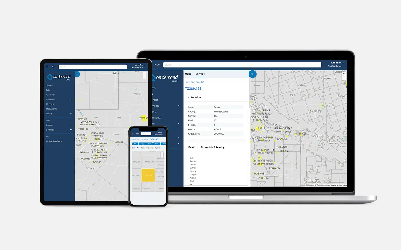
System of Record for ROW and Infrastructure Land Data
On Demand Land serves as the authoritative system of record for right-of-way agreements, easements, surface use rights, and landowner data. Land decisions stay grounded in secure, auditable information shared across engineering, construction, compliance, and operations teams.
Built for ROW Workflows, Not Disconnected Tools
Replace disconnected ROW tools, shared drives, and spreadsheets with governed workflows designed for acquisition, negotiation, construction access, and long-term maintenance. Every agreement and obligation is tracked across its full lifecycle.
Proven at Scale for Complex Infrastructure Portfolios
Support large pipeline and utility networks with workflows built for expansion, maintenance, and regulatory oversight, without sacrificing data quality or visibility.
Secure, Cloud-Native, and Always Current
Operate in a modern SaaS environment that meets SOC 2 Type 1 and Type 2 requirements, delivers seamless upgrades, and eliminates downtime without burdening IT teams.
Connected Document Management with Full Traceability
Centralize deeds, easements, permits, surveys, and correspondence. Apply OCR on import, link documents to parcels and corridors, and maintain full traceability to source records.
Proactive Obligations and Access Management
Track maintenance rights, inspection access, renewal terms, compensation schedules, and compliance deadlines using automated alerts and calendar-driven workflows.
Open APIs for Accounting, GIS, and Field Systems
Connect accounting system for landowner payments, accruals, and compensation tracking through comprehensive API access. Export land and corridor data to GIS and field tools to reduce manual effort and duplication.
Enterprise Reporting for Compliance and Oversight
Enable organization-wide visibility through configurable reporting that supports regulatory filings, audits, landowner communications, and executive oversight.
Infrastructure Expertise from People Who Know ROW
Work with teams who understand ROW acquisition, pipeline operations, and utility compliance. Get guided support, best practices, and responsive service throughout the lifecycle.
Trusted by Land Teams Managing Growth at Scale
Flywheel Energy has relied on On Demand Land for over five years to support growth, scale users across teams, and manage land data without adding complexity.
“The ability to get data in and out of the system is much easier, and the user interface allows more users to work in the system without technical backgrounds. As we’ve grown, On Demand Land has grown with us.”
– Whitney Katigan, Land Manager, Flywheel Energy
Flywheel also values early visibility into product roadmap updates and the ability to stay closely connected with Quorum’s product, development, and support teams.

20+
Years of Land Management
Expertise
ZERO
Downtime When
Delivering Updates
3M+
Land Assets Managed
in On Demand Land
Esri Cornerstone Partner
Quorum Software is a long-standing Esri Cornerstone Partner with over two decades of experience integrating ArcGIS technology into land and infrastructure workflows. This partnership enables accurate spatial analysis that stays synchronized with land records and agreements.

Right of Way and Land Management Key Features
Track permanent and temporary easements, construction rights, surface use agreements, and maintenance access across your full pipeline or utility footprint. Manage compensation and access restrictions with full auditability.
Visualize pipeline corridors, centerlines, parcels, stations, and facilities using embedded Esri GIS. Support corridor planning, spatial review, and multi-layer analysis for coordination across engineering, land, and compliance teams.
Access land data through universal search, keyword indexing, and integrated document management. Automatically OCR documents on import and link records to parcels, corridors, and facilities.
Maintain a complete landowner database with communication history, agreement terms, payment schedules, and claims tracking. Coordinate outreach across acquisition, construction, and operations.
Track federal, state, and local permits, environmental surveys, cultural resources, inspections, and renewals. Maintain a clear audit trail for regulatory reporting and internal governance.
A System of Record for Right-of-Way and Infrastructure Land
Designed for pipeline operators and utilities, On Demand Land unifies ROW data, easements, landowner agreements, GIS, and compliance workflows in one platform.
Download the overview to see how modern land teams replace fragmented land systems and disconnected tools with a secure, scalable system built for infrastructure portfolios.
FAQs
On Demand Land is a cloud-based land and right-of-way management platform built for pipeline operators, utilities, and infrastructure owners to manage easements, landowner agreements, permits, and corridor data in one governed platform.
Yes. The platform manages permanent and temporary easements, construction and maintenance access rights, surface use restrictions, and compensation tracking from acquisition through long-term operations.
Embedded Esri ArcGIS capabilities allow teams to visualize pipeline corridors, centerlines, parcels, facilities, and environmental constraints. Spatial data stays synchronized with land agreements and obligations in a single governed environment.
Yes. The system maintains a centralized database of landowners and stakeholders including contact details, communication history, assigned agents, agreement terms, and compensation tracking. This supports coordinated outreach and workload management across teams.
The platform tracks federal, state, and local permits, inspections, environmental and cultural assessments, and renewal deadlines. Automated alerts and audit trails help teams avoid missed obligations and stay prepared for regulatory reporting.
Yes. The platform provides API access to integrate with enterprise accounting systems, GIS platforms, and other operational tools. This keeps landowner payments, financial data, and corridor records aligned without manual reconciliation or duplicate entry.
Yes. The system is built to support large portfolios and multi-jurisdictional projects, complex corridor networks, and distributed teams while maintaining performance, data integrity, and governance.
AI-assisted document review and data extraction are available within governed workflows. Users validate outputs before they become part of the system of record, ensuring accuracy and auditability in regulated infrastructure environments.